


Manchester Big A-Z Street Atlas
Manchester Big A-Z Street Atlas
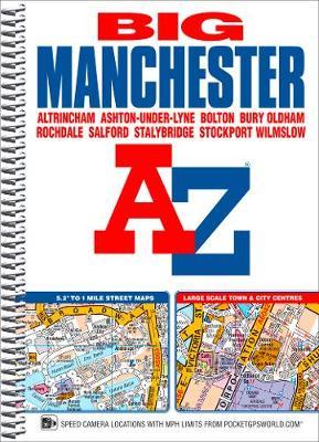
This spiral bound Big map of Manchester includes coverage of:
*Manchester
*Altrincham
*Ashton-under-Lyne
*Bolton
*Bury
*Oldham
*Rochdale
*Salford
*Stockport
The atlas includes 162 pages of continuous street mapping at a 'Big' 5.2 inches to 1 mile (8.2 cm to 1 km) extending to include coverage of:
*Cheadle
*Heywood
*Hyde
*Irlam
*Manchester Airport
*Poynton
*Prestwich
*Radcliffe
*Ramsbottom
*Stalybridge
*Swinton
*Urmston
*Wilmslow
There are also large scale city and town centre maps of Manchester, Altrincham, Ashton-under-Lyne, Bolton, Bury, Oldham, Rochdale and Stockport and a postcode map.
Postcode districts, one-way streets, safety camera locations with speed limits and National Park boundaries are also featured on the mapping.
The index section lists streets; selected flats, walkways and places of interest; place and area names; National Rail and Metrolink stations. There is a separate list of hospitals, hospices and NHS Walk-in Centres covered by the atlas.
An easy to follow map of the Manchester Metrolink is featured on the back cover.
PRP: 74.39 Lei
Acesta este Pretul Recomandat de Producator. Pretul de vanzare al produsului este afisat mai jos.
59.51Lei
59.51Lei
74.39 LeiPrimesti 59 puncte

Indisponibil
Descrierea produsului
This spiral bound Big map of Manchester includes coverage of:
*Manchester
*Altrincham
*Ashton-under-Lyne
*Bolton
*Bury
*Oldham
*Rochdale
*Salford
*Stockport
The atlas includes 162 pages of continuous street mapping at a 'Big' 5.2 inches to 1 mile (8.2 cm to 1 km) extending to include coverage of:
*Cheadle
*Heywood
*Hyde
*Irlam
*Manchester Airport
*Poynton
*Prestwich
*Radcliffe
*Ramsbottom
*Stalybridge
*Swinton
*Urmston
*Wilmslow
There are also large scale city and town centre maps of Manchester, Altrincham, Ashton-under-Lyne, Bolton, Bury, Oldham, Rochdale and Stockport and a postcode map.
Postcode districts, one-way streets, safety camera locations with speed limits and National Park boundaries are also featured on the mapping.
The index section lists streets; selected flats, walkways and places of interest; place and area names; National Rail and Metrolink stations. There is a separate list of hospitals, hospices and NHS Walk-in Centres covered by the atlas.
An easy to follow map of the Manchester Metrolink is featured on the back cover.
*Manchester
*Altrincham
*Ashton-under-Lyne
*Bolton
*Bury
*Oldham
*Rochdale
*Salford
*Stockport
The atlas includes 162 pages of continuous street mapping at a 'Big' 5.2 inches to 1 mile (8.2 cm to 1 km) extending to include coverage of:
*Cheadle
*Heywood
*Hyde
*Irlam
*Manchester Airport
*Poynton
*Prestwich
*Radcliffe
*Ramsbottom
*Stalybridge
*Swinton
*Urmston
*Wilmslow
There are also large scale city and town centre maps of Manchester, Altrincham, Ashton-under-Lyne, Bolton, Bury, Oldham, Rochdale and Stockport and a postcode map.
Postcode districts, one-way streets, safety camera locations with speed limits and National Park boundaries are also featured on the mapping.
The index section lists streets; selected flats, walkways and places of interest; place and area names; National Rail and Metrolink stations. There is a separate list of hospitals, hospices and NHS Walk-in Centres covered by the atlas.
An easy to follow map of the Manchester Metrolink is featured on the back cover.
Detaliile produsului
De pe acelasi raft
-

PRP: 98.88 Lei
79.10 Lei
79.10 Lei98.88 Lei
-
PRP: 82.58 Lei
66.06 Lei
66.06 Lei82.58 Lei
-
PRP: 61.06 Lei
48.85 Lei
48.85 Lei61.06 Lei
-
PRP: 247.92 Lei
198.34 Lei
198.34 Lei247.92 Lei
-
PRP: 154.69 Lei
123.75 Lei
123.75 Lei154.69 Lei
-
PRP: 198.75 Lei
159.00 Lei
159.00 Lei198.75 Lei
-
PRP: 98.87 Lei
79.10 Lei
79.10 Lei98.87 Lei
-
PRP: 98.87 Lei
79.10 Lei
79.10 Lei98.87 Lei
-
PRP: 105.40 Lei
84.32 Lei
84.32 Lei105.40 Lei
