


Ultimate UK Cycle Route Planner Map


Ultimate UK Cycle Route Planner Map
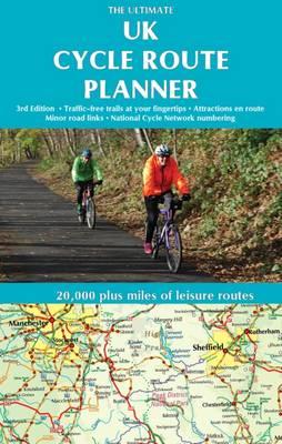
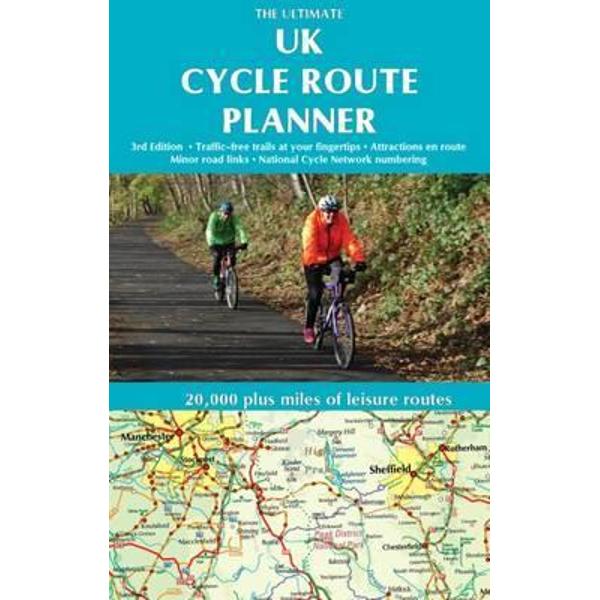
All of the UK's signed cycle routes brought together on one map - now a comprehensively updated and expanded 3rd edition. Using the outstanding quality and detail of Times Comprehensive Atlas mapping, Sustrans' National Cycle Network and other popular cycle trails are featured and defined - traffic free or on road. Family cyclists will love the listed traffic free trails. Third edition features include:* Sustrans National Cycle Network route numbers shown, corresponding with route signage on the ground* Attractions (stately homes, country parks, museums etc) on or near suggested routes* New clearer route designOther routes include regional routes such as county cycle ways and those National Trails on which bikes are allowed such as the Pennine Bridleway and the Ridgeway. Many hundreds of miles of minor road routes are also shown and links to signed cross-channel routes such as the Avenue Verte (London-Paris) are shown so that long distance route planning is also made easy. A bespoke key makes the map easy to understand at a glance.The UK's rail network and its myriad of stations is detailed, showing at a glance where and how cyclists can combine bike and train to get access to the country's best cycling.
As the scale of the map makes it suitable for planning rather than navigation, full details are given of where you can get larger scale maps of popular rides, such as the C2C, the Devon Coast to Coast and the Way of the Roses. * Superb quality mapping showing thousands of villages, towns and cities linked by the UK's ever expanding cycle network (network number signs now on map). * Compiled by specialist cycle guide publisher Excellent Books, run by established cycle journalist Richard Peace. * Sustrans' National Cycle Network, minor roads, National Trails, attractions en route, the UK rail and canal network - all this brought together on one map to make a unique and invaluable planning tool.
As the scale of the map makes it suitable for planning rather than navigation, full details are given of where you can get larger scale maps of popular rides, such as the C2C, the Devon Coast to Coast and the Way of the Roses. * Superb quality mapping showing thousands of villages, towns and cities linked by the UK's ever expanding cycle network (network number signs now on map). * Compiled by specialist cycle guide publisher Excellent Books, run by established cycle journalist Richard Peace. * Sustrans' National Cycle Network, minor roads, National Trails, attractions en route, the UK rail and canal network - all this brought together on one map to make a unique and invaluable planning tool.
PRP: 73.22 Lei
Acesta este Pretul Recomandat de Producator. Pretul de vanzare al produsului este afisat mai jos.
65.90Lei
65.90Lei
73.22 LeiPrimesti 65 puncte

Indisponibil
Descrierea produsului
All of the UK's signed cycle routes brought together on one map - now a comprehensively updated and expanded 3rd edition. Using the outstanding quality and detail of Times Comprehensive Atlas mapping, Sustrans' National Cycle Network and other popular cycle trails are featured and defined - traffic free or on road. Family cyclists will love the listed traffic free trails. Third edition features include:* Sustrans National Cycle Network route numbers shown, corresponding with route signage on the ground* Attractions (stately homes, country parks, museums etc) on or near suggested routes* New clearer route designOther routes include regional routes such as county cycle ways and those National Trails on which bikes are allowed such as the Pennine Bridleway and the Ridgeway. Many hundreds of miles of minor road routes are also shown and links to signed cross-channel routes such as the Avenue Verte (London-Paris) are shown so that long distance route planning is also made easy. A bespoke key makes the map easy to understand at a glance.The UK's rail network and its myriad of stations is detailed, showing at a glance where and how cyclists can combine bike and train to get access to the country's best cycling.
As the scale of the map makes it suitable for planning rather than navigation, full details are given of where you can get larger scale maps of popular rides, such as the C2C, the Devon Coast to Coast and the Way of the Roses. * Superb quality mapping showing thousands of villages, towns and cities linked by the UK's ever expanding cycle network (network number signs now on map). * Compiled by specialist cycle guide publisher Excellent Books, run by established cycle journalist Richard Peace. * Sustrans' National Cycle Network, minor roads, National Trails, attractions en route, the UK rail and canal network - all this brought together on one map to make a unique and invaluable planning tool.
As the scale of the map makes it suitable for planning rather than navigation, full details are given of where you can get larger scale maps of popular rides, such as the C2C, the Devon Coast to Coast and the Way of the Roses. * Superb quality mapping showing thousands of villages, towns and cities linked by the UK's ever expanding cycle network (network number signs now on map). * Compiled by specialist cycle guide publisher Excellent Books, run by established cycle journalist Richard Peace. * Sustrans' National Cycle Network, minor roads, National Trails, attractions en route, the UK rail and canal network - all this brought together on one map to make a unique and invaluable planning tool.
Detaliile produsului
De pe acelasi raft
-

PRP: 105.34 Lei
94.81 Lei
94.81 Lei105.34 Lei
-
PRP: 115.86 Lei
104.27 Lei
104.27 Lei115.86 Lei
-
PRP: 122.06 Lei
109.85 Lei
109.85 Lei122.06 Lei
-
PRP: 108.39 Lei
97.55 Lei
97.55 Lei108.39 Lei
-
PRP: 160.89 Lei
144.80 Lei
144.80 Lei160.89 Lei
-
PRP: 123.93 Lei
111.54 Lei
111.54 Lei123.93 Lei
-
PRP: 131.36 Lei
118.22 Lei
118.22 Lei131.36 Lei
-
PRP: 101.59 Lei
91.43 Lei
91.43 Lei101.59 Lei
-
PRP: 136.09 Lei
122.48 Lei
122.48 Lei136.09 Lei
