


Los Glaciares National Park Map 2 Perito Moreno & Upsala Glaciers, Lago Argentino, El Calafate, Zona Roca Trekking/Hiking/Walking Topographic Map Atla
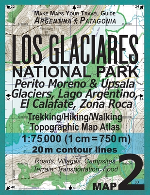
Los Glaciares National Park Map 2 Perito Moreno & Upsala Glaciers, Lago Argentino, El Calafate, Zona Roca Trekking/Hiking/Walking Topographic Map Atla
The map scale of 1:75000 (1 cm = 750 meters) provides a wide coverage of the area in good detail while keeping low the weight of the atlas itself. The large page format of 8.5x11in minimizes page count and along with the overlapping map design allows for comfortable navigation. The details included in the topographic maps of this Atlas were specifically selected to be useful for trekkers, hikers and walkers of all interests, and make it easy to plan and enjoy both shortexcursions and hikes as well as long multi-day adventures along the main marked routes and/or adjacent trails and paths, which are alsoshown on the maps. With this ultralight atlas you will always have a detailed, reliable, information-rich, battery-independent, shatter-proof map for youradventure.Mercator projection SAD69 with both UTM and WGS84 coordinate grids.
PRP: 115.86 Lei
Acesta este Prețul Recomandat de Producător. Prețul de vânzare al produsului este afișat mai jos.
104.27Lei
104.27Lei
115.86 LeiPrimești 104 puncte

Livrare in 2-4 saptamani
Descrierea produsului
The map scale of 1:75000 (1 cm = 750 meters) provides a wide coverage of the area in good detail while keeping low the weight of the atlas itself. The large page format of 8.5x11in minimizes page count and along with the overlapping map design allows for comfortable navigation. The details included in the topographic maps of this Atlas were specifically selected to be useful for trekkers, hikers and walkers of all interests, and make it easy to plan and enjoy both shortexcursions and hikes as well as long multi-day adventures along the main marked routes and/or adjacent trails and paths, which are alsoshown on the maps. With this ultralight atlas you will always have a detailed, reliable, information-rich, battery-independent, shatter-proof map for youradventure.Mercator projection SAD69 with both UTM and WGS84 coordinate grids.
Detaliile produsului


