


Mapping Texas: A Cartographic Journey, 1561-1860
Mapping Texas: A Cartographic Journey, 1561-1860
3,822 perimeter miles. 11,247 rivers and streams. 8,749 feet at its height. 268,596 square miles in total. Texas is big. Julius Caesar once quipped that all of ancient Gaul could be divided up into three parts. Texas resists such easy division.
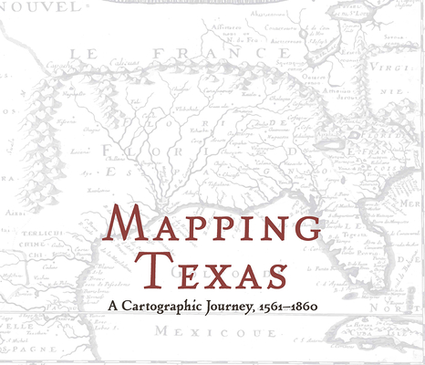
Mapping Texas, edited by John S. Wilson, presents an array of early maps, dating from 1561 to 1860. The volume features selections from the extensive material housed in the Frances C. Poage Map Room of The Texas Collection at Baylor University. The painstaking labors of Spanish, French, English, and Mexican mapmakers illustrate the progressive and differing views of Texas geography and boundaries. Originally used as guides to new destinations, these maps also staked new claims, fueled by new dreams, on new territory that settlers had heard about but never seen. Page by page, Texas' iconic shape gradually emerges. As now-familiar cities dot this vast expanse of land, railroads trace the outline of rivers and mountain ranges, and ports anchor the curve of the Gulf of Mexico, Texas' rich history comes to life one map at a time. The volume concludes with an analysis of map art and cartouches--beautiful images that both name the map and highlight flora and fauna. A sumptuous delight for mind and eye, this volume lavishly documents the early outlines of the land over which six flags have proudly flown.PRP: 185.94 Lei
Acesta este Prețul Recomandat de Producător. Prețul de vânzare al produsului este afișat mai jos.
148.75Lei
148.75Lei
185.94 LeiPrimești 148 puncte

Indisponibil
Descrierea produsului
3,822 perimeter miles. 11,247 rivers and streams. 8,749 feet at its height. 268,596 square miles in total. Texas is big. Julius Caesar once quipped that all of ancient Gaul could be divided up into three parts. Texas resists such easy division.
Mapping Texas, edited by John S. Wilson, presents an array of early maps, dating from 1561 to 1860. The volume features selections from the extensive material housed in the Frances C. Poage Map Room of The Texas Collection at Baylor University. The painstaking labors of Spanish, French, English, and Mexican mapmakers illustrate the progressive and differing views of Texas geography and boundaries. Originally used as guides to new destinations, these maps also staked new claims, fueled by new dreams, on new territory that settlers had heard about but never seen. Page by page, Texas' iconic shape gradually emerges. As now-familiar cities dot this vast expanse of land, railroads trace the outline of rivers and mountain ranges, and ports anchor the curve of the Gulf of Mexico, Texas' rich history comes to life one map at a time. The volume concludes with an analysis of map art and cartouches--beautiful images that both name the map and highlight flora and fauna. A sumptuous delight for mind and eye, this volume lavishly documents the early outlines of the land over which six flags have proudly flown.Detaliile produsului


