


The World Reference & Map Forms: Grades 3-6
The World Reference & Map Forms: Grades 3-6
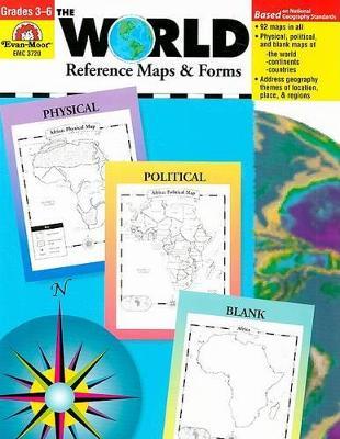
The World--Reference Maps & Forms contains 92 maps, evaluation forms, a crossword puzzle, a word search, and an answer key. The first section, The World, includes: - an introduction of general facts about the world - a list of 192 countries in the world - a reference political map of the continents - a blank world map - Robinson and Mercator projection maps - globes, showing hemispheres, parallels, and meridians - maps of oceans, rivers, mountain ranges, and deserts The second section, The Continents, includes: North America: - an introduction, listing the countries, area, population, elevations, and fun facts about the continent - reference political and physical maps of North America, Canada, the United States, and Mexico - blank outline maps of North America, Canada, the United States, and Mexico--shape, political, and physical - study maps of each region of the United States and Mexico and the provinces and territories of Canada - a reference map of six regions of the United States - study maps of Central America, the Greater Antilles, and a reference map of the Lesser Antilles Africa, Europe, Asia, and Australia - an introduction, listing the countries, area, population, elevations, and fun facts about the continent - a reference political and a physical map of the continent (a political map of Oceania is included with Australia) - blank outline maps of the continent--shape, political, and physical - study maps of regions of the continent Antarctica and the Arctic Region - an introduction, listing the area, elevations, and fun facts about the continent - reference polar projection maps of Antarctica and the Arctic Region - a reference map of the scientific stations in Antarctica - blank outline projection maps of Antarctica and the Arctic Region
PRP: 123.94 Lei
Acesta este Prețul Recomandat de Producător. Prețul de vânzare al produsului este afișat mai jos.
111.55Lei
111.55Lei
123.94 LeiPrimești 111 puncte

Livrare in 2-4 saptamani
Descrierea produsului
The World--Reference Maps & Forms contains 92 maps, evaluation forms, a crossword puzzle, a word search, and an answer key. The first section, The World, includes: - an introduction of general facts about the world - a list of 192 countries in the world - a reference political map of the continents - a blank world map - Robinson and Mercator projection maps - globes, showing hemispheres, parallels, and meridians - maps of oceans, rivers, mountain ranges, and deserts The second section, The Continents, includes: North America: - an introduction, listing the countries, area, population, elevations, and fun facts about the continent - reference political and physical maps of North America, Canada, the United States, and Mexico - blank outline maps of North America, Canada, the United States, and Mexico--shape, political, and physical - study maps of each region of the United States and Mexico and the provinces and territories of Canada - a reference map of six regions of the United States - study maps of Central America, the Greater Antilles, and a reference map of the Lesser Antilles Africa, Europe, Asia, and Australia - an introduction, listing the countries, area, population, elevations, and fun facts about the continent - a reference political and a physical map of the continent (a political map of Oceania is included with Australia) - blank outline maps of the continent--shape, political, and physical - study maps of regions of the continent Antarctica and the Arctic Region - an introduction, listing the area, elevations, and fun facts about the continent - reference polar projection maps of Antarctica and the Arctic Region - a reference map of the scientific stations in Antarctica - blank outline projection maps of Antarctica and the Arctic Region
Detaliile produsului


