


Tsali Trails Map
Tsali Trails Map
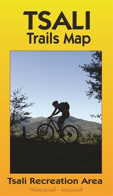
With over 40 miles of single track, western North Carolina's Tsali Recreation Area, where trails wind their way over rolling terrain along the shore of Lake Fontana just across from Great Smoky Mountains National Park, has been a major Southeastern mountain bike destination since the 1980s.
This waterproof color topo map shows routes for all four of Tsali's loops, including elevation profiles, the trail schedule for bikes and horses, and information on the USFS campground. It even suggests nearby forest road alternatives for riding when it's too wet at Tsali.PRP: 61.69 Lei
Acesta este Prețul Recomandat de Producător. Prețul de vânzare al produsului este afișat mai jos.
49.35Lei
49.35Lei
61.69 LeiPrimești 49 puncte

Livrare in 2-4 saptamani
Descrierea produsului
With over 40 miles of single track, western North Carolina's Tsali Recreation Area, where trails wind their way over rolling terrain along the shore of Lake Fontana just across from Great Smoky Mountains National Park, has been a major Southeastern mountain bike destination since the 1980s.
This waterproof color topo map shows routes for all four of Tsali's loops, including elevation profiles, the trail schedule for bikes and horses, and information on the USFS campground. It even suggests nearby forest road alternatives for riding when it's too wet at Tsali.Detaliile produsului


